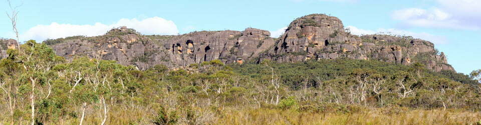
Thursday 2/07/2026 The Governor Lookout – Governor Mountain (Corrunbral Borawah)
Mount Kaputar National Park, NSW
Gamilaroi Country (Gamilaroi, Kamilaroi, Gomeroi, Gamilaraay people)
Participants: Stephen Davies (Photos), Sue Davies (Report)
It was a wild night during which a storm blew through. The morning was again misty, windy and cold. We delayed our departure hoping the weather would clear. Soon the rain eased off, so we rugged up and headed out for this short walk.
Wednesday 1/07/2026 Dawsons Spring Campground – Bundabulla Link Track – Mount Dowe – Horsearm Lookout – Bundabulla Circuit – Eckford Lookout – Bundabulla Lookout – Lindsey Rock Tops Track – Lindsay Rock Tops – Mount Lindsay – Dawsons Spring Nature Trail
Mount Kaputar National Park, NSW
Gamilaraay/Gomeroi Country (Gamilaroi, Kamilaroi, Gomeroi, Gamilaraay people)
Participants: Stephen Davies (Photos), Sue Davies (Report)
It was a cool, windy and damp morning as we decided what we should do for the day. The weather forecast was quite grim for the next few days. We decided we would rug up and go out looking for the giant pink slugs, which are endemic to this area. It seemed perfect weather for slugs!
Wednesday 1/07/2026 Coryah Gap – Mount Coryah Walking Track – Mount Coryah
Mount Kaputar National Park, NSW
Gamilaroi Country (Gamilaroi, Kamilaroi, Gomeroi, Gamilaraay people)
Participants: Stephen Davies (Photos), Sue Davies (Report)
As we only had a few hours after lunch before dusk, we decided on this walk as it was relatively short.
We drove the short distance from our camp at Dawsons Spring to the Coryah Gap picnic area where the trail began. It was a gradual climb initially up the stepped lava terraces and some stairs to reach the cliff face of Mount Coryah. Here we saw a pack of goats and a few eastern grey kangaroos.
Participants: Stephen Davies (Photos), Sue Davies (Report)
From our starting position, we needed to backtrack to visit these caves. Since the signage along the Newell Highway was poor, we drove straight past initially. However, it ended up being worth the visit even though there were some paths closed.
Participants: Stephen Davies (Photos), Sue Davies (Report)
We decided to visit this small National Park on our trip north despite the forecast of rain for the next two days. Entering the park involved driving more than 20km on unsealed roads with several “creek crossings”. I phoned the National Parks office, which indicated we should be fine as it would take a lot of rain to wash out the road.
Thursday 17/09/2026 Charlotte Pass Village – Charlotte Pass – Main Range Walking Track – Snowy River at Foremans Crossing – Club Lake Creek – Carruthers Peak – Carruthers Creek – Blue Lake Walk – Blue Lake
Kosciuszko National Park, NSW
Ngarigo Country (Monaro Ngarigo people)
Participants: Sue Davies (Photos, Report), Jean Crane (Leader), Patrick Lorrimer, Swantje (Swan) Lorrimer, Peter Whittle, Ian Houghton and Caroline Houghton
Wednesday 16/09/2026 Charlotte Pass Village – Charlotte Pass – Mount Kosciuszko Summit Walk – Seamans Hut – Etheridge Ridge – Rawson Pass – Mount Kosciuszko
Kosciuszko National Park, NSW
Ngarigo Country (Monaro Ngarigo people)
Participants: Sue Davies (Photos, Report), Patrick Lorrimer (Leader), Jean Crane (for part of the trip), Swantje (Swan) Lorrimer
Tuesday 15/09/2026 Charlotte Pass Village – Charlotte Pass – Main Range Walking Track – Snowies Walking Track – Snowy River – Spencers Creek Footbridge – Illawong Lodge
Kosciuszko National Park, NSW
Ngarigo Country (Monaro Ngarigo people)
Participants: Sue Davies (Photos, Report), Andrew Bonney (Leader), Vicki Bonney, Peter Whittle, Patrick Lorrimer, Swantje (Swan) Lorrimer
Monday 14/09/2026 Perisher Valley – Galaxia Place – Porcupine Track Walking – Rock Creek – Porcupine Rocks – Snowies Alpine Walk stage 3 – Trapyard Creek – Wrights Creek – Spencers Creek – Charlotte Pass Village – Southern Alps Ski Club
Kosciuszko National Park, NSW
Ngarigo Country (Monaro Ngarigo people)
Participants: Sue Davies (Leader, Photos, Report), Bill, Peter Whittle
The weather was misty and windy in the morning, with rain threatening. We decided to stay relatively low in amongst the trees to avoid the wind on the peaks. Steve is out of action this week with bone bruising in his knee, so he was more than happy to drive us to Perisher to start the walk.
10/06/2026 – 12/06/2026Whitehaven Beach South – Solway Circuit – South Whitehaven Beach Lookout – Solway Passage – Chance Bay Walk – Chance Bay – Nargo Track – Chance Bay Campsite – Theos Point Lookout – Bari Dhil Lookout – Camp 1: Bowarri yamba (Moon Camp) – Craig Point Lookout – Whitsunday Craig Lookout – Whitsunday Craig – Bilbili dhilli Lookout – Crayfish Bay Lookout – Camp 2: Dhula yamba (Tree Camp) – Torres Herald Bay – Gumi – Murmuru bari Lookout – Hill Inlet Lookout Platform – Bettys Beach – Tongue Point
Ngaro Track
Whitsunday Islands National Park, QUEENSLAND
Ngaro Country (Ngaro people)
Distance: 35.7km Total Ascent: 1495m Total Descent: 1463m
Time: 18 hours
Participants: Matt Aistro, James Anthony, Stephen Davies (Photos), Sue Davies (Report), Katie, Cecelia McLoughlin, Matt Madin, Rachel, Kylie Shirvington, Philip Whitmore, Summer and River [15 altogether]
Three unforgettable days on the Ngaro Track delivered everything you could want from a Whitsunday Islands adventure—wild weather, sweeping island vistas, rich cultural landscapes, and a constantly changing mix of coastal and forest environments. Starting with a rough, rain-soaked boat ride to the dazzling white sands of Whitehaven Beach, this journey quickly set the tone for a challenging and rewarding trek across Ngaro Country.
Covering 35.7 km with significant elevation gain, the track links secluded bays, panoramic lookouts, ancient hoop pine forests, mangrove wetlands, and pristine beaches. Each day revealed something new—from ridge-top camps overlooking turquoise waters to close encounters with remarkable wildlife. Shared with a great group of walkers, this hike was as much about camaraderie as it was about the landscape, with every step offering another reason to pause, photograph, and take it all in.
Participants: Stephen Davies (Photos), Sue Davies (Report)
We started the day with a civilised cuppa at the Sails Cafe before walking along Catseye Beach with views of our destination at Passage Peak. We took the Scenic Trail to Saddle Junction with the aim of walking to Middle Head first. There was some confusion with the trail signage, with some backtracking before we reached the pleasant views from Middle Head. There were very few people on these wide pleasant trails.
Participants: Stephen Davies (Photos), Sue Davies (Report)
After completing the 7:00am parkrun there was still plenty of time to hit the trails. There are 20km of trails on the island and it’s our aim to complete all of these during our stay.